3D Workspace
Home
Assets
Affiliate Program
Creator Program
Sign up/Log in
View Plans
DCC Bridge
Anonymous1774376158
03-24 18:26
Model Name
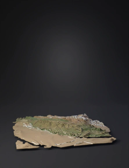
iran topographic 3d model
Tags
iran
nature environment
nature environment realistic
nature environment rendering
nature environment rendering realistic
realistic
rendering
rendering realistic
terrain
Prompt
Accurate real-world 3D topographic terrain of entire Iran strictly from SRTM/ASTER satellite DEM data. Perfect geological fidelity: parallel folded thrust ridges of Zagros Mountains with deep gorges (SW-NE orientation), sharp high Alborz range with Damavand 5610m, perfectly flat Khuzestan alluvial plain, central Iranian plateau with salt deserts, accurate Persian Gulf coastline and Kharg Island. Realistic Landsat satellite texturing, hypsometric coloring green lowlands to brown to white high peaks. 1.65x vertical exaggeration for strategic clarity. Thin white international borders. Small red dots for key cities: Tehran Ahvaz Khorramshahr Abadan Bandar Abbas Tabriz Mashhad. Clean high-detail mesh, photorealistic shading and slope texturing, no artistic style, maximum satellite accuracy, ready for strategic map use.
Detailed Info
Related Models
Enter invite code
Enter invite code to get credits!
 Anonymous1774376158


 Anonymous1774376158